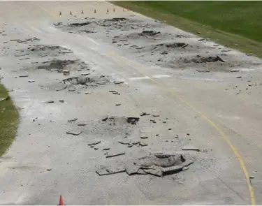
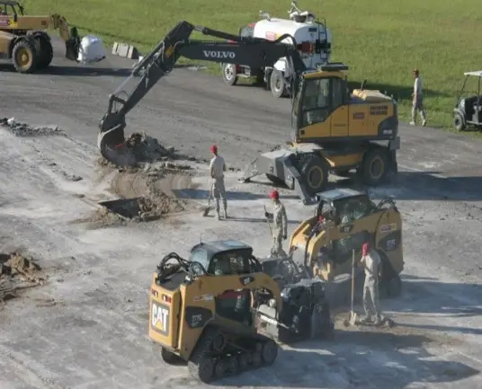
Rapid Airfield Damage Assessment System (RADAS)
RADAS is designed to support the entire damage assessment process required to identify and classify damage and unexploded ordinances (UXO) on the airfield. RADAS if fielded and supported across dozens of USAF installations across the globe and is developed and maintained by DS2. GeoExPT is the primary user interface and command and control client for the process. To accomplish the process faster and safer, several other applications have been fielded to support this process including GAS, ADR Client, IRAA, IRAA Mobile, and ATAK.
GeoExPT ADR Synchronization (GAS)
The Geo-Spatial Expeditionary Planning Tool(GeoExPT) and Airfield Damage Repair(ADR) Synchronization system; GAS as it is referred to, is the primary mechanism for exchanging any data between the different systems and software within the Rapid Airfield Damage Assessment (RADAS) Family of Systems for the U.S. Air Force. GAS provides the underlying messaging platform, data repository and rules engine for collaboration between clients, which is the cornerstone of the RADAS and Rapid Airfield Damage Repair (RADR) processes. GAS controls the dissemination of full motion video (FMV) and geospatial imagery captured from various platforms used on the airfield to identify and classify damage and UXO’s across the entire installation. GAS also contains other capabilties, like a Map Server, Voice to Text, and Media Server services. See Downloads to get a copy of the software.
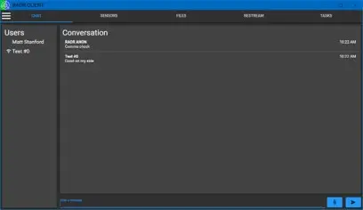
RADR Client
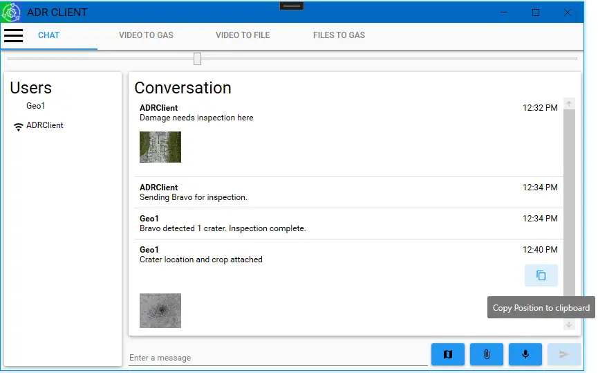
The Rapid Airfield Damage Repair (RADR) Client is a lightweight application that provides a connection into the GAS ecosystem for any user. The RADR Client provides basic tools to help manage the RADAS process by providing chat, user management, sensor management, video stream management (FMV) and file management. Users can easily chat within anyone through GAS and any of the other connected clients including GeoExPT, IRAA Mobile, and ATAK. RADR Client also allows a user connected to a sUAS to connect to a specific sensor and have its video feed streamed to the GAS Media Server and then shared with any other clients. Any addition, the RADR Client can act as a file sharing system, similar to how DropBox works, allowing any client to quickly retrieve images or any other files automatically shared. See Downloads to get a copy of the software.
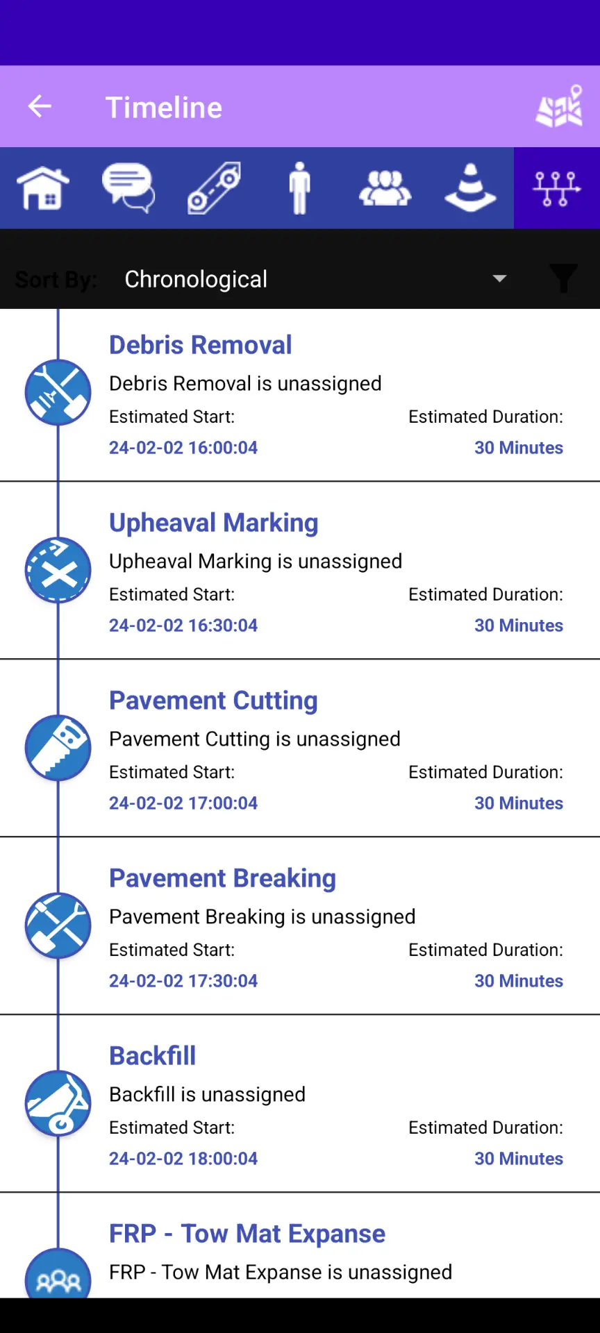
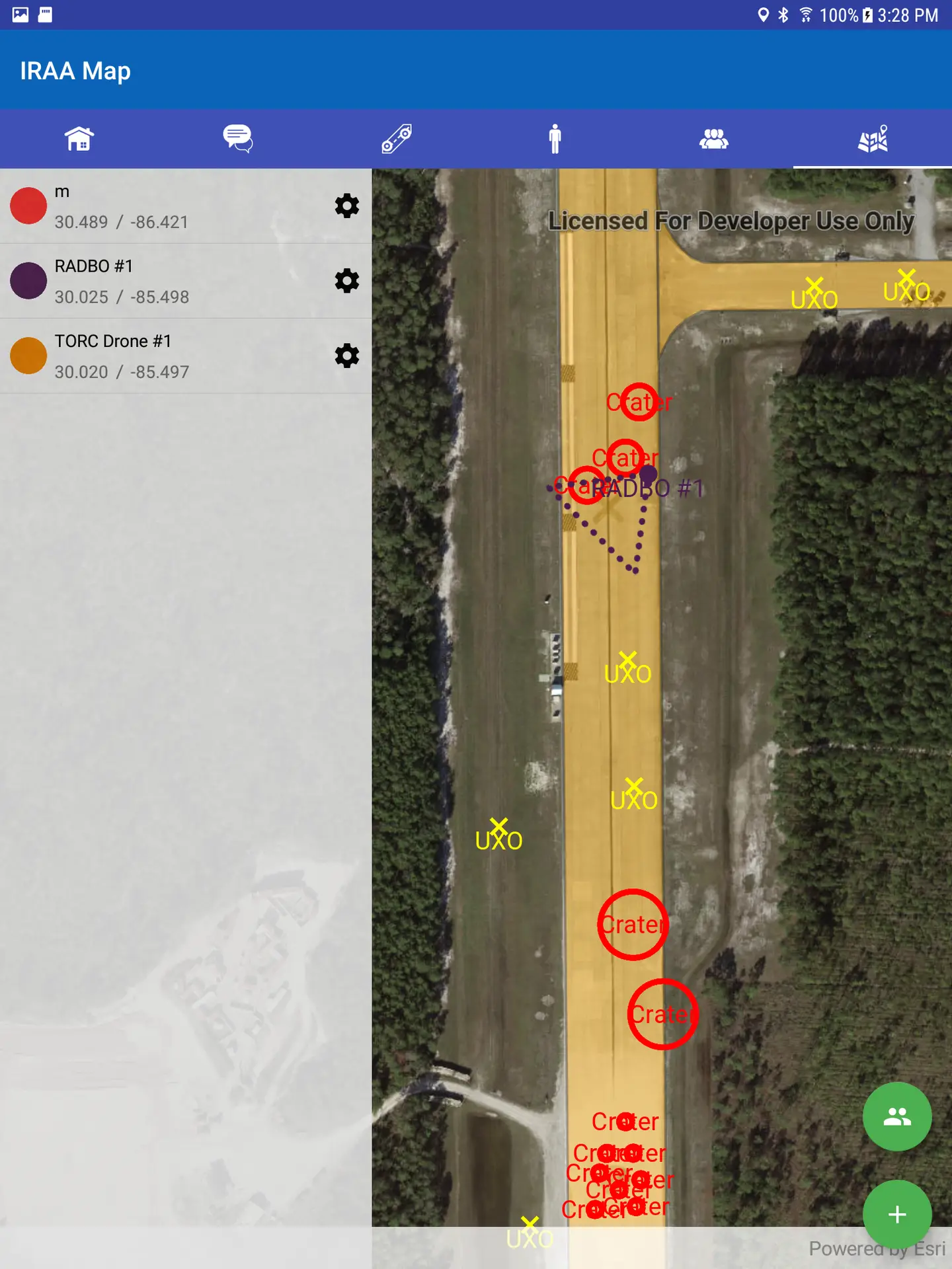
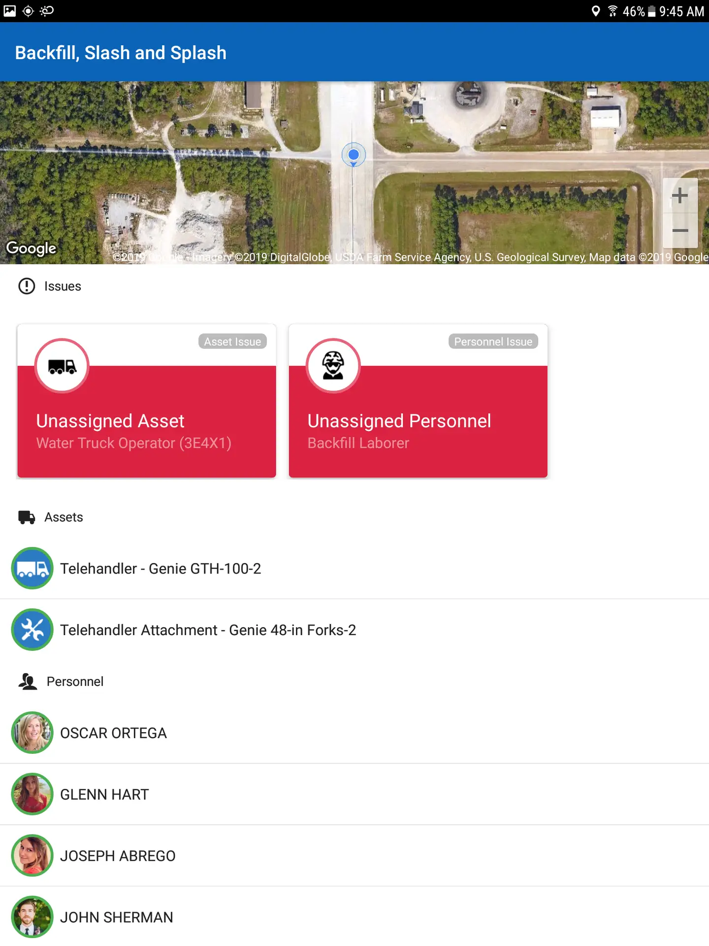
IRAA Mobile
The Installation Recovery After Attack (IRAA) Mobile solution allows support for both assessment and repair processes under ADR. IRAA Mobile includes the ability to manage users, teams, tasks, chat, and provides location and situational awareness of all other users. IRAA Mobile has built in safety rules that will automatically alert a user of any safety concerns or violations, from operating equipment without a license, proximity to a UXO cordon, or even traffic lane concerns. For the assessment process IRAA Mobile is also used by Airfield Damage Assessment Teams (ADAT) to provide the ability to enter in damages and UXO’s on the airfield or across the installation. Finally, IRAA Mobile also provides the ability for users to complete Dead, Injured, Missing, Equipment (DIME) check ins. All of this data is managed centrally by GAS to provide complete situational awareness. See Downloads to get a copy of the software.
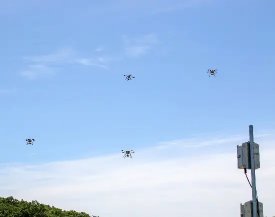
Small Unmanned Air Systems (sUAS) Integrations
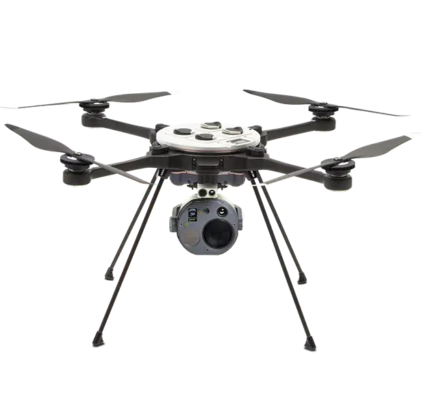
GeoExPT can display compliant FMV from any sUAS that can stream data directly to GAS or via a file stream. This includes drones like the Parrot or Skydio based on the Blue sUAS program. The RADR Client has first class integration with the fielded sUAS solution provided by FLIR, the R80 SkyRaider. The RADR client can automatically detect the SkyRaider and it sensors and set up streaming from the Ground Control Unit (GCU) to GAS and its clients. In addition, RADR can pass points and data directly into the FLIR GCU to allow operators to easily manage RADAS taskings. With the sUAS integrations, an airframe can quickly fly over the airfield and provide the FMV/Imagery into GAS and thus the entire ecosystem. From there, GeoExPT can view the FMV/Imagery directly on the map and use that to determine the state of the runway and any required repairs or mitigation steps. The sUAS Integrations allows operators to quickly identify and classify damage without the human risk of walking the airfield to find the damage and UXO’s, all while doing this much faster.